Know What Fish
Are Biting Today
Real-time bite scores for 416 waterbodies across all 50 states. Free.
How It Works
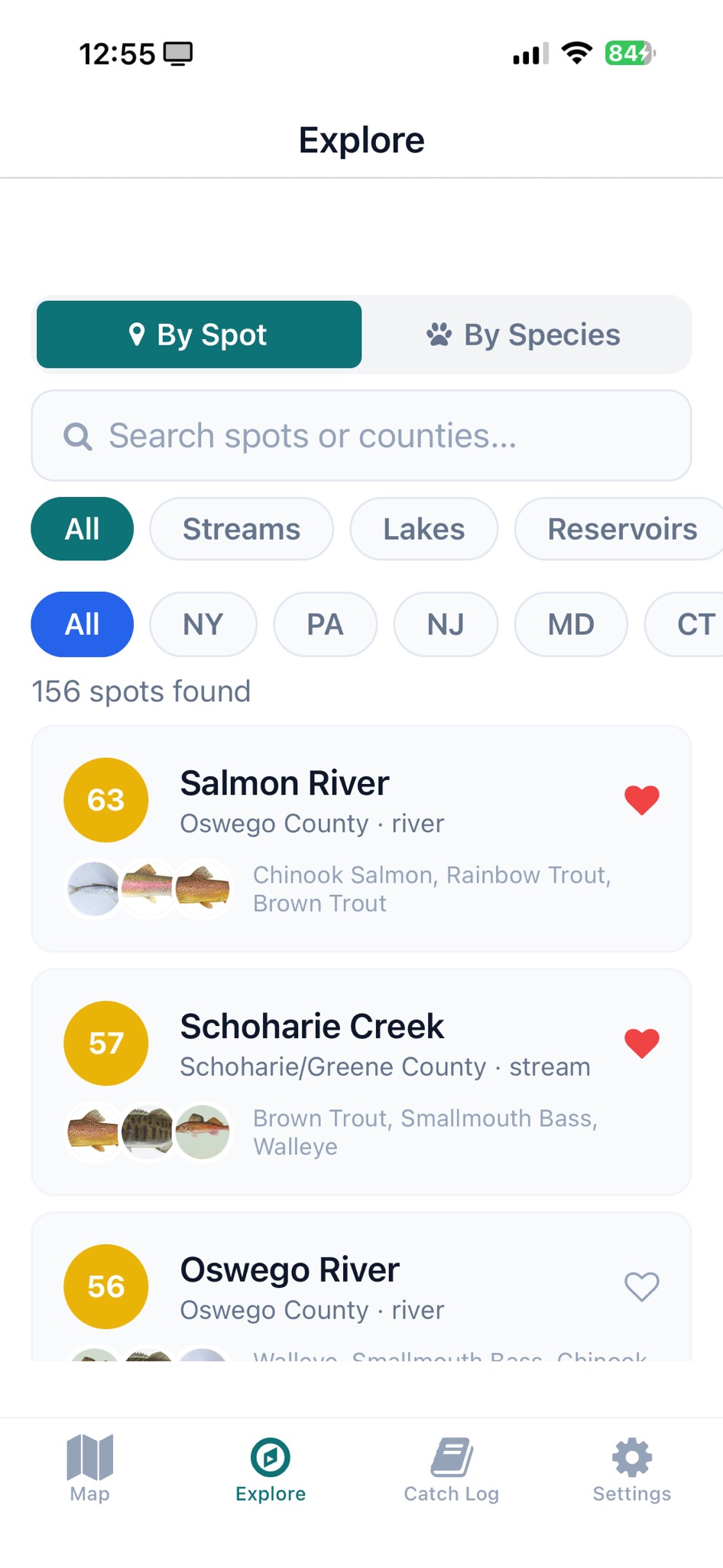
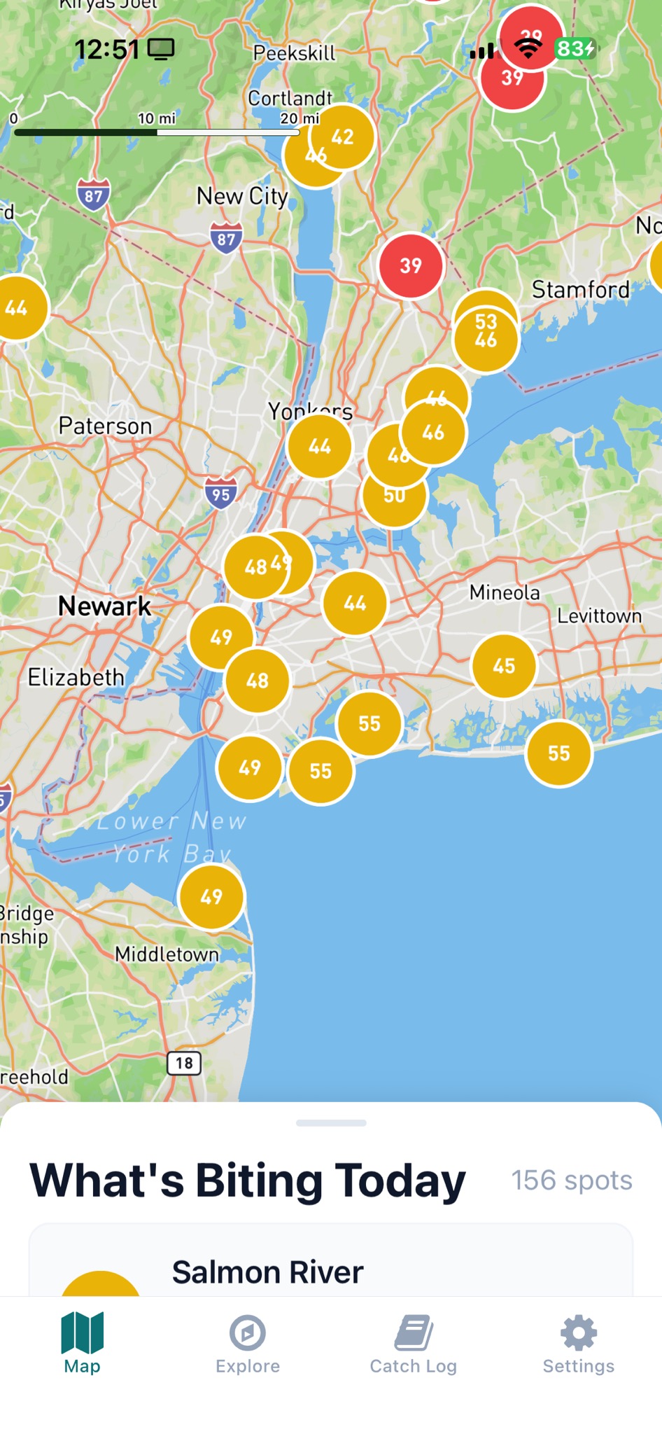
Find a spot
Browse 416 waterbodies by state, species, or distance. See bite scores at a glance.
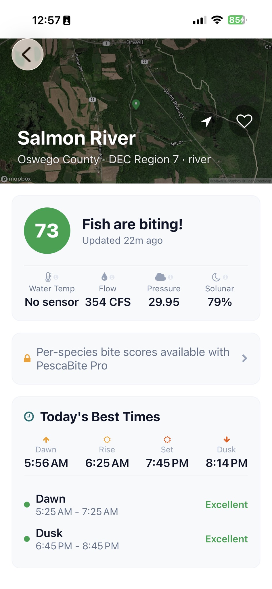
Check conditions
Live bite score, water temp, pressure, tides, best times, and gear advice.
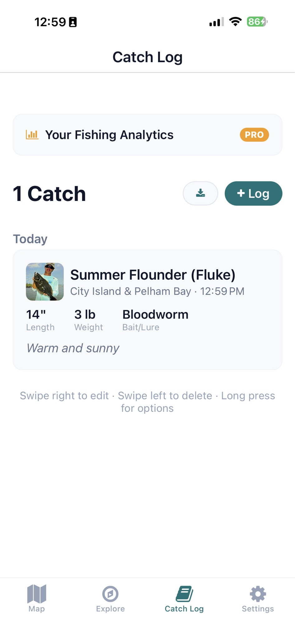
Log your catch
Private catch log with photos, measurements, and personal analytics.
What Sets PescaBite Apart
Multi-Factor Bite Score
Tailored scoring for rivers (9 factors), lakes (8 factors), and saltwater (with tides). Updated every 30 minutes from USGS, NOAA, and solunar data.
Verified Regulations
Season dates, size limits, bag limits, and gear restrictions from official state sources. Works offline.
Works Without Signal
Regulations, waterbody data, and cached scores available offline. Download map tiles for remote spots.
Private Catch Log
Your catches stay yours. Photos, measurements, and notes — never shared, never sold. We don't burn spots.
416 Waterbodies Across All 50 States
From Catskill trout streams to Chesapeake Bay rockfish, Texas largemouth, Florida tarpon, Rocky Mountain trout, Pacific Northwest salmon and steelhead, Alaska's Kenai River, and Hawaii's reef and bluewater. Every state. Every kind of water.
104 species · 441 tackle shops · 598 boat launches · 210 charters & guides
PescaBite Pro
- AI fish identification from photos
- Per-species bite scores
- 7-day fishing forecast
- Personal fishing analytics and charts
- Curated how-to-catch video guides
- Offline map tiles
- Export catch log to CSV
$4.99/mo or $29.99/yr· 7-day free trial
Start Free Trial